A city built on an ancient salt marsh
Flood risk in Dénia has a historical explanation. The city centre grew during the twentieth century on an ancient saladar, a low-lying, damp area by the sea which in the nineteenth century was levelled with rubble from the walls to drive urban expansion towards the southeast. The 2023 General Structural Plan describes this decision as "disastrous": the result is a large flood-prone area, with high frequency and considerable water depth, through which the preferred water flow from a 500-year-old watercourse runs through practically all the streets of the neighbourhood.
Geography compounds the problem. The Santa Paula ravine runs directly into the Saladar at the height of Torrecremada and, from that point, is fed by ravines flowing down from Montgó. The entire southeast flank of the city centre is thus exposed.
Neighbourhoods at very high risk
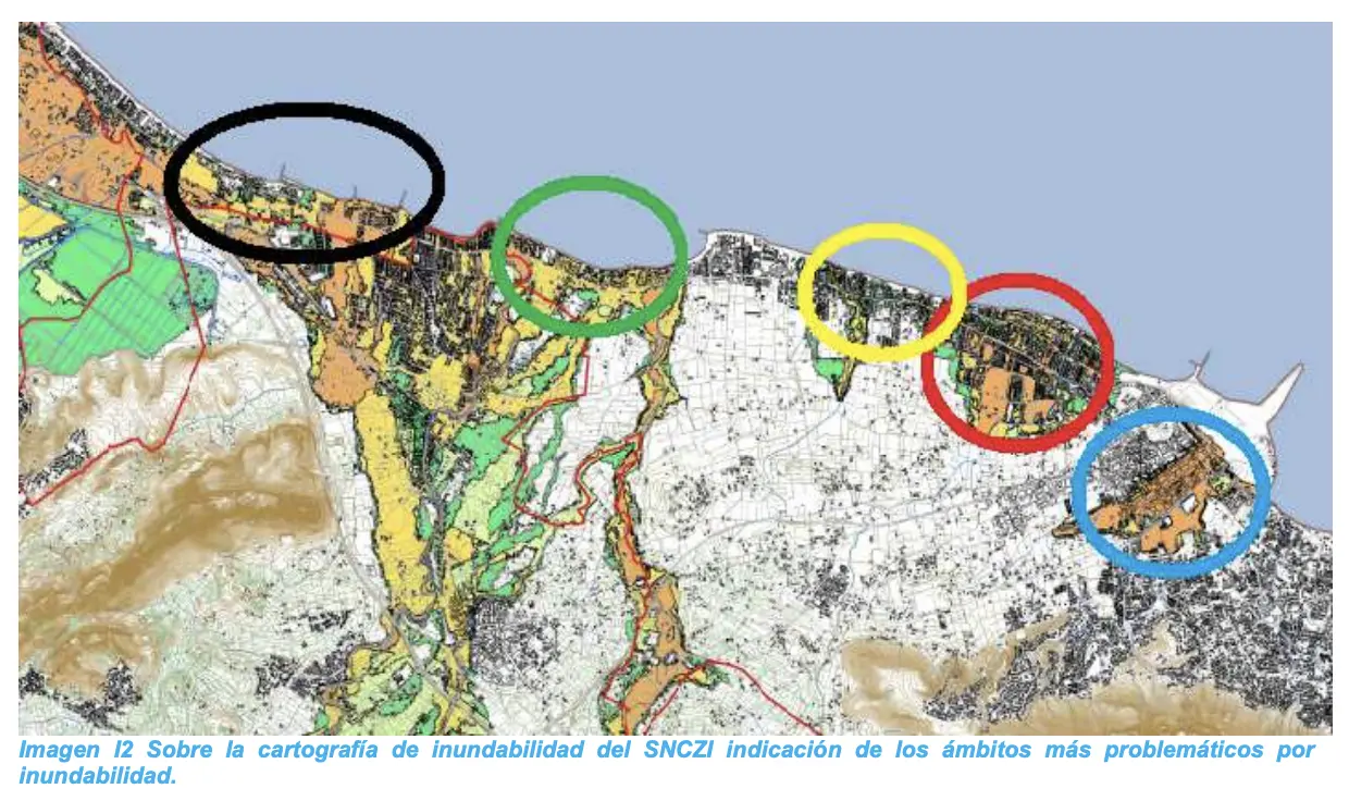
The flood risk study prepared in 2018 for the General Plan classifies the territory into five risk levels: very low, low, medium, high and very high. Two large areas appear at the highest level.
The first is the Saladar, stretching from avenida Joan Fuster to practically carrer de la Via, and from plaça de Jaume I to the TRAM station. At the same level are streets close to the station, in the area around carrer Doctor Manuel Lattur, and the final stretch of carrer Marqués de Campo, on the side facing the sea.
The second is Les Marines, the part of the municipality presenting very high flood risk. The first urban stretch of Les Marines sits on a depression associated with the riverbeds of Regatxo and les Basetes, and the urbanisations of Les Marines and Les Deveses are linked to ravines and rivers that empty into their coastline: Alter, Alberca, Girona and Racons.
The map reveals a striking contrast: areas of very low or low risk coexist, metres apart, with others of very high risk. The side of Marqués de Campo further from the sea and the area around the Castle, because of their height, present no risk.
Frequency and depth of water
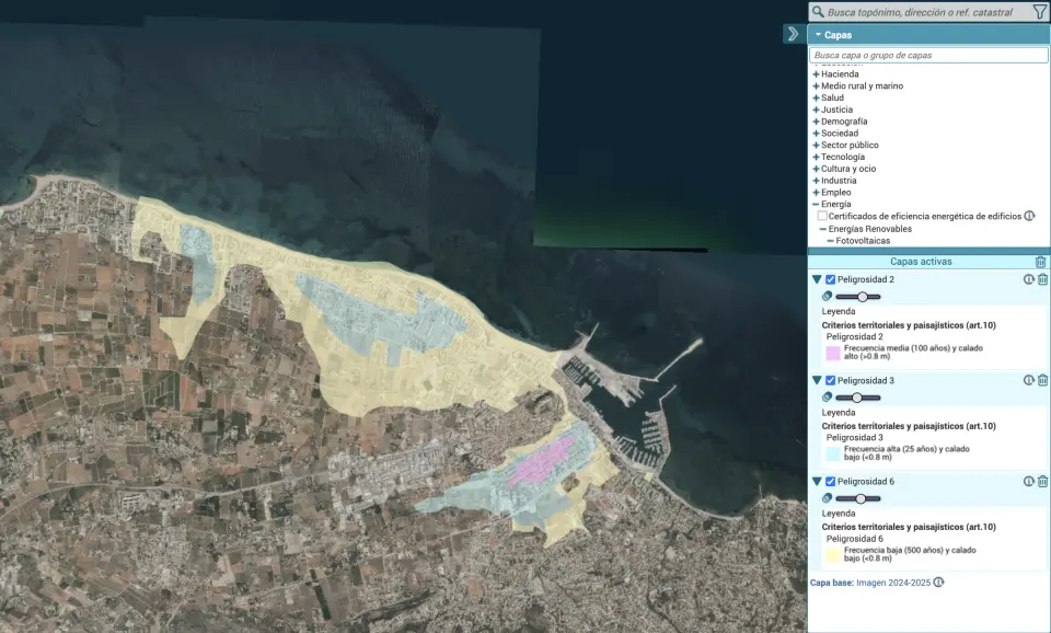
Beyond risk, the studies measure hazard, which combines two factors: how often flooding can occur (the return period) and how high the water can reach (the depth). Valencian regulations, PATRICOVA, establish six levels. Level 1, the most serious, corresponds to flooding that can recur within 25 years with more than 80 centimetres of water. Level 6, the least serious, to episodes occurring between 100 and 500 years apart with depths of 15 to 80 centimetres.
In Dénia, the most dangerous zone is again the Saladar, classified at level 2: flooding with medium frequency, around every 100 years, and depths over 80 centimetres. At level 3, with frequent flooding (every 25 years) but less than 80 centimetres of water, is the entire Saladar from the beach inwards, to Torrecremada and the innermost part of Les Marines.
The study also identifies geomorphological hazard, which depends on the shape of the terrain, particularly in the port area and agricultural areas to the west of the municipality.
A history of flooding
The Saladar is not a theoretical risk. The 2018 study records flooding suffered by the city since the mid-twentieth century:
- 27 October 1958. The Riatxol ravine flooded the Saladar area. Water reached 80 centimetres on carrer Patricio Ferrándiz and Dénia lost communication with Les Marines.
- 15 November 1985. New flooding in the Saladar.
- 3 and 4 November 1987. Water reached 1.5 metres in shops and basements on paseo del Saladar and Patricio Ferrándiz. The road to Les Rotes and stretches of the Les Marines road were cut. A levanter storm also broke the drainage channel.
- October 1991. Plaça del Archiduque Carlos and the roads to Les Marines and Les Rotes were flooded.
- 20 August 1995. Water inundated paseo del Saladar, plaça del Archiduque, plaça de Jaume I and Patricio Ferrándiz.
- 10 December 1995. The same areas flooded again, plus carrer Sagunto, with 138 litres per square metre.
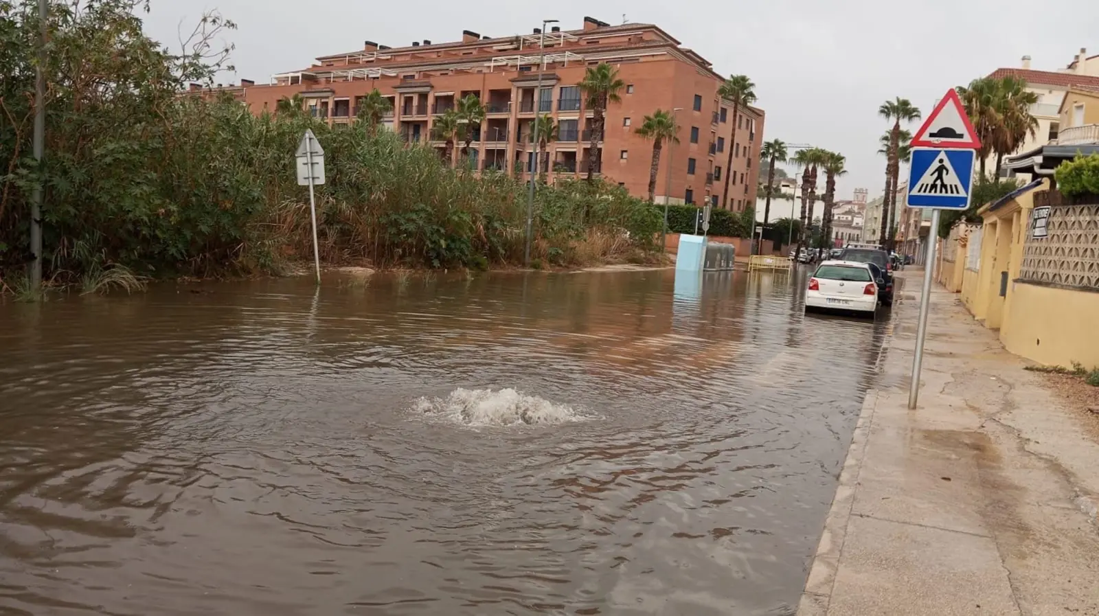
Today, whenever notable rainfall occurs, even if not extraordinary, crossroads such as plaça París Pedrera or avenida Joan Fuster become watercourses.
Rural areas and wetlands
Outside the city centre, the General Plan notes extensive areas threatened by the Regatxo, Alter, Alberca, Girona and Racons riverbeds. These are rural areas with few vulnerable uses. One of them, the Racons wetland, in the far west of the municipality, is protected by regional regulations and extends into neighbouring Pego and Oliva.
The park designed to control water from Montgó
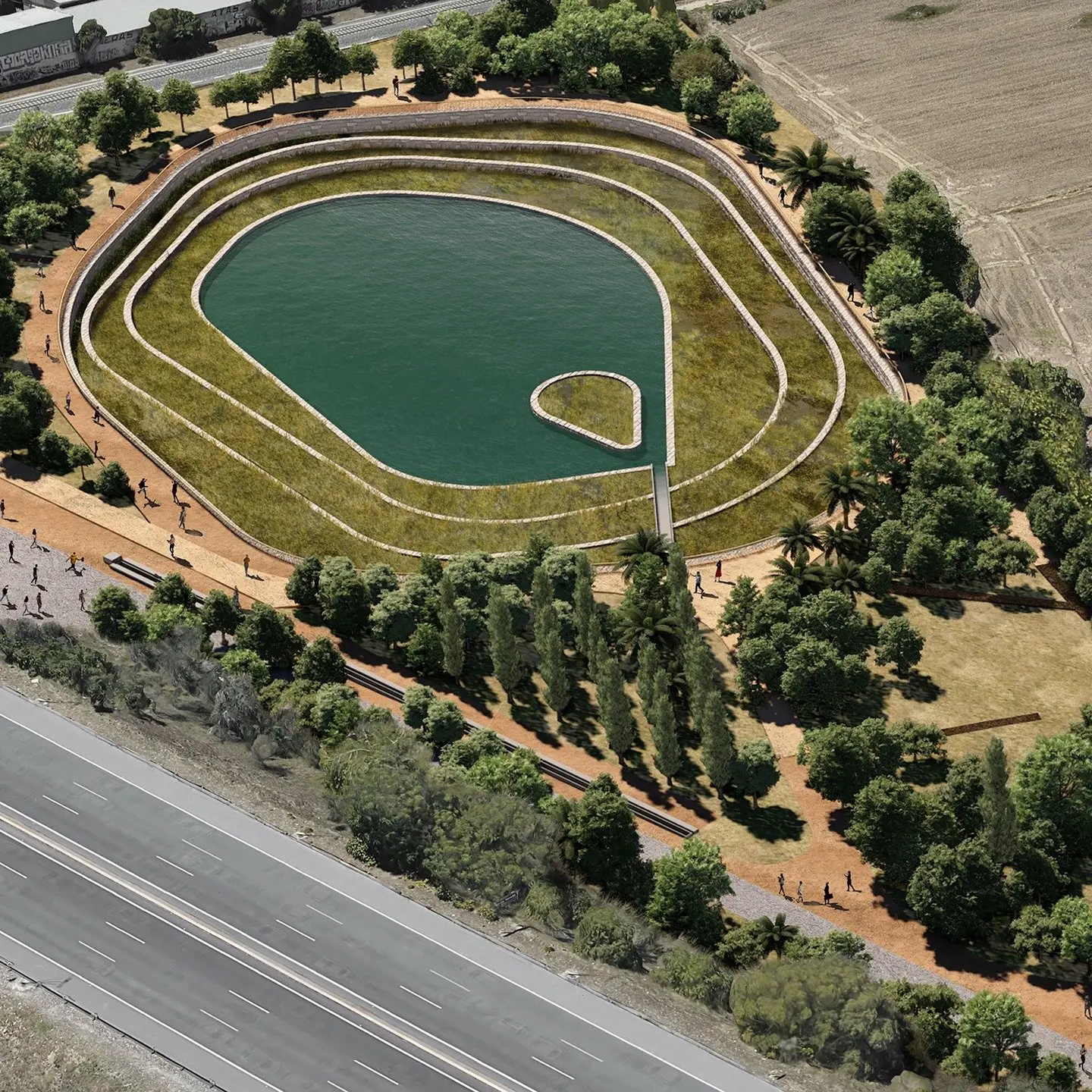
The main measure planned against flooding is the Alqueries park. The Town Council presented the special plan for this 14-hectare green space in March, more than double the current Bosc de Diana, bounded by avenida Joan Fuster, Camí de Sant Joan and carrer Gesmí.
The park is designed to function as a large sponge: it will absorb much of the water flowing down from Montgó ravines and retain it temporarily to prevent it reaching the city centre. According to the municipal government, it would reduce the hazard level especially around plaça París Pedrera and avenida Joan Fuster. It will be open to the public and have paths crossing it north to south, but will not include urban elements such as children's play areas, because its main function is to control water.
The Territory Councillor, Maria Josep Ripoll, presented it as a long-term project. Processing has just begun, funding must be secured and the land belongs to the same company that previously blocked Bosc de Diana, which would receive in exchange building rights in the future northern ring road. The local government itself acknowledged it could face difficulties again.
What to do if a warning is issued
Aemet has maintained an orange warning for rainfall in Marina Alta active since this Thursday, with accumulated amounts of up to 50 litres per square metre in one hour. In such episodes, the areas marked on flood risk maps are the first to experience water. The official maps can be consulted in the PATRICOVA mapping viewer of the Generalitat and in the National System of Flood-Prone Area Mapping of the Ministry for Ecological Transition, where any resident can check the risk level of their street.