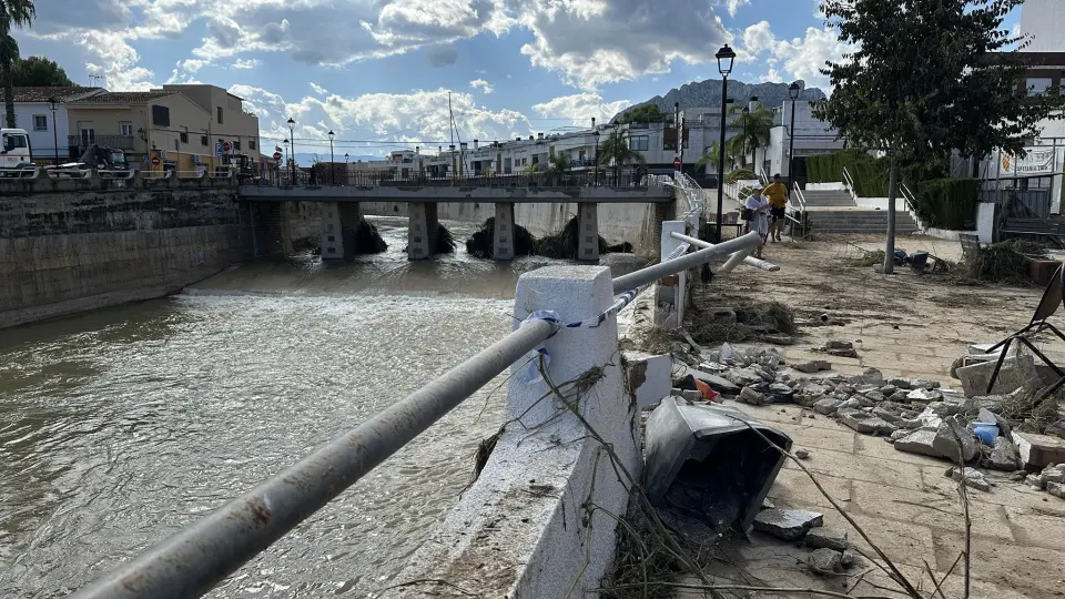
The Third Vice-Presidency and Department of Environment, Infrastructure, Territory and Recovery of the Valencian Government has undertaken work to document with precision the extent of the flooding caused by Storm Adam, which brought extraordinary rainfall on 18 and 19 October. The aim is to establish with accuracy how far the water reached, the depth it attained at each point and how the flood spread across both comarcas.
The Directorate General of Town Planning, Landscape and Environmental Assessment activated this field work immediately after the storm occurred. The Service for Risk Management in the Territory is responsible for gathering information on the ground, noting the data necessary to delimit the affected zones and the water levels reached in each of them.
To do this, technical staff visit buildings and infrastructure looking for marks left by the flooding, recording them with georeferenced tools that incorporate photographs and data associated with each located point. All this material is incorporated into geographic databases and processed using geographic information systems (GIS), so that each observation is linked to its exact location. With this field work, the regional department expects to have a graphic representation that reflects both the extent of the flooded zones and the different water levels recorded.
Among the areas affected by the storm is the Girona river basin, where damage reached municipalities such as Els Poblets, as well as the Marjal lands and agricultural holdings in the surroundings of Pego. As La Marina Times previously reported, the Valencian Government had already intervened in several municipalities in the area to remove debris left by the storm.
Review of watercourses and risk maps
Parallel to this cartographic survey, the same Directorate General is studying the condition of watercourses, ravines and drainage systems, with the aim of detecting possible erosions or changes in drainage capacity caused by the flooding. The results of both studies will be compared with existing flood hazard maps, with a view to updating the risk information available for Marina Alta and Safor, in line with other measures launched by the regional administration following the storm, such as the detection of damage to forest tracks in the area.
In the municipalities of Els Poblets and Vergel, both affected by the rise in the Girona river, the need to review hydraulic infrastructure and strengthen maintenance of the watercourses in the area has been raised.